امروز جمعه ۳۱ فروردین ۱۴۰۳
دسته بندی سایت
برچسب های مهم
پیوند ها
LIDAR stands for light detection and ranging, it is an active form of remote sensing. It does not require electromagnetic radiation rather it record laser pulses that strike the object and back to the sensor. LIDAR measures the distance from the sensor to the object by determining the time between the release of laser pulse to receiving of the reflected pulse. Then multiplying this time by the speed of the light and dividing by two will give the distance between the sensor and the target. For terrestrial uses LIDAR uses near infrared laser (900–1064 nanometers) and water penetration green light (532 nanometers) for the water measurement. Nowadays LIDAR is used everywhere, we have collected 50 most important applications.
DEM (Elevation Value):
1. DEM (Elevation Value): DEM stands for digital elevation model which has z coordinates value along with x and y. Elevation values are used everywhere, in roads, building, bridge and other. It has made easy to capture the surface height. Before LIDAR, ground survey or photogrammetry method was used to capture the z coordinates but the problem with this method was time consuming. LIDAR has made things easier and quicker.
Micro-Topography
2. Micro-Topography: LIDAR is very accurate and precise technology which uses laser pulse to strike the object. Regular photogrammetry or other survey technology can miss the surface elevation value that is hidden by vegetation or forest canopy. But LIDAR can penetrate through the object and detect the surface value.
Agriculture
3. Agriculture: LIDAR helps the farmer to find the area that uses costly fertilizer. LIDAR can be used to create elevation map of the farmland that can be converted to create slope and sunlight exposure area map. Both the layer information can be used to create high, medium and low crop production area. Extracted information will help farmer to save on the costly fertilizer.
Forest
4. Forest Planning and Management: LIDAR is widely used in the forest industry to plan and mange. It is used to measure vertical structure of forest canopy and also used to measure and understand canopy bulk density and canopy base height. Other uses of the LIDAR in the forest industry is the measurement of the peak height to estimate its root expansion.
Forest Fire Management
5. Forest Fire Management: LIDAR is becoming widely popular in forest fire management. Fire department is transforming from reactive to proactive fire management. LIDAR image helps to monitor the possible fire area which is called fuel mapping (fire behavior model). On this article author discuss, how British Colombia is using LIDAR information for the fire management.
Precision Forestry
6. Precision Forestry: Precision Forestry is define as planning and operating the site specific forest area to increase the productivity of wood quality, reduce cost and increase profits, and maintain the environment quality. LIDAR and aerial photo is used to perform precision forestry. Article on “Lidar Applications in Precision Forestry” talks in detail about its uses.
Tourism
7. Tourism and Parks Management: LIDAR DEM is used to plan the park and tourism area. High accurate land surface model helps to find the best area to have playground, trees and walking trail. Parks management is a big business and LIDAR technology is playing a vital role for its management.3D image of the park, generated from LIDAR technology helps for the future growth of the park.
Environmental Assessment
8. Environmental Assessment: Micro topography data generated form the LIDAR data is used in the environment assessment. Environment assessment is done to protect the plants and environment. Remote sensing and surface information (LIDAR) is used to find the area that is affected by the human activities.
Biodiversity for Birds
9. Biodiversity for Birds: As LIDAR technology is evolved in finding detail information about the forest. Forest are home for different type of birds, animals and insects. Scientist are using LIDAR data to analyze forest (vertical structure) to see whether it is suitable place for them. Vertical Structure of trees, shrubs and other plant tells, what species can live and prosper in that area.
Flood Model
10. Flood Model: LIDAR provides very accurate information. River is very sensitive and few meter of change in information can bring disastrous or loss of properties. So LIDAR is used to create high resolution and accurate surface model of the river. These extracted LIDAR information can be used for the 3D simulation for better planning of the structures or buildings on the river bank.
Watershed and Stream Delineation
11. Watershed and Stream Delineation: DEM generated from LIDAR is used to create watershed area and stream line delineation. High and accurate DEM is the major input to create this and GIS software is used to create it. This way you can calculate watershed for the particular water channels and find out stream channel for over land flooding.
ELC
12. ELC: ELC is short form of Ecological & Land Classification. It is done to provide the biological and physical information of the Landscape which helps in the sustainable management. ELC process helps in the range of sector like land use planning, environmental assessment, forest management, habitat management and many more. During the classification of Land, high resolution LIDAR data helps to understand the nature and type of the land, that will help in the ELC process.
River Survey
13. River Survey: Water penetration green light (532 nanometers) of the LIDAR is used to measure under water. Under water information is required to understand depth, flow strength, width of the river and more. For the river engineering, its cross section data is extracted from LIDAR data (DEM) to create a river model, which will create flood way and flood fringe map. In same way to understand sea under world, LIDAR data is used by the marine engineer.
Modelling of the Pollution
14. Modelling of the Pollution: LIDAR wavelength are shorter which operates in ultraviolet, visible region or near infrared. This helps to image the object which are in same size or larger than the wavelength. So LIDAR can detect pollutant particles of carbon dioxide, Sulphur dioxide and methane. This information helps researched to create pollutant density map of the area which can be used for better planning of the city.
Mapping
15. Mapping: Surface model created from LIDAR is used to add graphical value to maps. DEM (from LIDAR) is added underneath of all layers that shows the 3D view of the land. Especially LIDAR data (DEM) is added on the aerial photography to show the 3D view which makes easier to plan roads, buildings, bridges and rivers.
16. Management of Coastline: LIDAR data of the coastline surface and under the water surface can be combined by researches to analyze the waves behavior and area covered by them. If these data are captured periodically then marine scientist can understand the coastline erosion occurrence.
Transport Planning
17. Transport Planning: LIDAR data for road helps engineer to understand it and give a roadmap for the building it. As LIDAR are highly accurate technology it helps to understand width, elevation and length of the existing road. Road engineer use LIDAR data for below things as well:
Calculate Cut & fill, culvert sizing, vegetation removal, grade calculations and more.
Height clearances
Right of way and surface conditions
Oil and Gas Exploration
18. Oil and Gas Exploration: As LIDAR wavelength are shorter, it can be used to detect molecules content in the atmosphere that has same or bigger wavelength. There is the new technology called DIAL (Differential Absorption LIDAR) which is used to trace amount of gases above the hydrocarbon region. This tracking helps to find the Oil and Gas deposits.
Mining
19. Mining: LIDAR is also used in the mining business in various task. It is used to measure the ore volume by taking series of photos of ore extraction space. These interval photos are used to calculate the volume.
Archeology
20. Archeology: LIDAR has played important part for the archeologist to understand the surface. As LIDAR can detect micro topography that is hidden by vegetation which helps archeologist to understand the surface. DEM created from LIDAR is feed into GIS system and it is combined with other layer for analysis and interpretation.
Exploring Quarries and Minerals Area
21. Exploring Quarries and Minerals Area: For Archaeology it is important to understand human civilization by finding the quarry and minerals site. So LIDAR is used to detect these spot.
Viewshed Analysis
22. Viewshed Analysis: Viewshed analysis is common name in GIS, it uses digital elevation model (DEM) to create viewshed map. It uses individual cell to determine that is visible or not from all other remaining cells. Accuracy of analysis depends on the inputted DEM. So high accurate DEM generated from LIDAR is used for these type of analysis.
Solar Energy Planning
23. Solar Energy Planning: Solar energy are getting popular for heating and electricity purpose. Solar panel are used to absorb the heat energy from the sun and it is converted to heat or electricity energy. For the installation of the Solar panel there are some basic requirements which are identified by the help of the LIDAR data. Like Solar panel should be kept to south facing of the roof and it should have minimum area and so on. To find out more about uses of LIDAR data in solar energy planning, read on page 12.
Right to Light
24. Right to Light: Every house owner has right for the light, other type of construction should not block the light for the individual. As LIDAR data can capture 3D model of the building, GIS analysis can be used to produce shadow map which shows illumination area during particular time of the day.
Glacier Volume Changes
25. Glacier Volume Changes: : LIDAR is used to calculate the glacier change over the period. LIDAR image are taken in time series to see the change happening. For example, LIDAR image was taken of Iceland from 2007-2009 and project was completed on 2012. These captured data will help scientist to know the amount of volume change.
gaming
26. Gaming: LIDAR technology is used to capture the surrounding area and this data is feed into the computer and color code is added to it. For example for the race track game, LIDAR will be used to capture the view of the real race track. This captured race track data will be used for the game.
Accident Scene
27. Accident Scene: Ground based LIDAR can be used to capture the accident and crime scene. LIDAR technology can be used quickly to record the accident scene on the road that can be used later for the investigation. This allow the traffic to flow smoothly if there is the accident.
Architecture
28. Architecture: Ground based LIDAR technology can be used to capture the buildings structure. This digital information can be transfer to computer for architecture to design the house model.
recording of building
29. Recording of Building: Ground based LIDAR can be used to record the inside of the house. It can be used to record the interior design too. This extracted data can be printed on the 3D printer to model it. Or when building is rebuild this recorded information can be used to restore the interior design.
BIM
30. BIM: GIS is a valuable tool that helps in the planning, organizing and subsequent growth in the energy and utilities industries. The effective management of energy systems is a complex challenge. GIS has enormous potential for planning, design and maintenance of facility. Also it provide improved services and that too cost effectively.
Cellular Network Planning
31. Cellular Network Planning: LIDAR can survey the area with less time compared to other method. The collected surface model can be feed into the GIS system to create the line of sight or viewshed map. This outputted map can help cellular engineer to find proposed cellular antenna.
Vehicle Automation
32. Vehicle Automation: LIDAR is becoming more popular in vehicles to make it automatic. LIDAR is used to grab the information on the road and it is passed to computerized system to make a human being like decision. For example, LIDAR can detect the road yellow lines which tells the vehicle to stay within yellow lines. Nowadays vehicle uses Adaptive Cruise Control (ACC) which has LIDAR technology. It helps vehicle that is in cruise control to slow down when there is vehicle in the front and also speed up when there is no traffic.
Sewer and Manhole Survey
33. Sewer and Manhole Survey: There are some place in the sewer line where that is not accessible by human being physical. In this situation sensor attached with the robotic machine are sent into the pipe for survey. This information are later feed into computer for analysis.
Meteorology:
34. Meteorology: LIDAR has been used for study of the cloud and its behavior since it was invented. It uses its wavelength to strike small particles in the cloud to understand it. There are different kinds of LIDAR presents which does typical task in the cloud.
Elastic backscatter LiDAR: It is the simplest type of LiDAR and is typically used for studies of aerosols and clouds.
Differential Absorption LiDAR (DIAL): It is used for the measurements of a gas like ozone, carbon dioxide, or water vapor.
Raman LiDAR: It is also used for measuring the concentration of atmospheric gases but also to take the quantity of aerosol parameters present.
Doppler LiDAR: It is used to measure wind speed.
geology
35. Geology: In geology the combination of LIDAR aircraft and GPS has evolved so much it is used finding the fault and measuring the uplift. The combination of above technology was used to find the Seattle fault in the Washington State, USA. NASA satellite called ICESAT that has LIDAR sensor is used to monitor glaciers and perform coastal change analysis.
Astronomy
36. Astronomy: In the exploration of MARS, LIDAR technology was used to create the topographic map of the red planet (the NASA Mars Global Surveyor). NASA’s Phoenix Lander used LIDAR technology to the detect snow falling in the Mars atmosphere.
Atmospheric Physics
37. Atmospheric Physics: In the Atmospheric Physics, LIDAR is used to measure the concentration of oxygen, nitrogen, potassium, sodium and other gas particles in the middle and upper atmosphere. This information is used to create the density map.
Oceanography
38. Oceanography: LiDAR is used for calculation of phytoplankton fluorescence and biomass in the ocean surface. It is also used to measure the depth of the ocean (bathymetry). Typical example will be measuring of the coral Reef.
Military
39. Military: LIDAR has always been used by the military people to understand land. It creates high resolution map for the military purpose. They use LIDAR technology to understand the war place.
40. COPS: It is quite common technology in the law enforcement department. Police uses LIDAR gun to detect the speed of the vehicle and also to understand the traffic flow. This technology is so precise that they can pick up the targeted vehicle from the cluttered traffic.
Forensic
41. Forensic: 3D Laser scanning or LIDAR is becoming quite popular in forensic examination. Though the technology is new, it is embraced by police department, law enforcement agencies and government crime agencies.
Imaging
42. Imaging: LIDAR technology is used to create 3D image of the object that is in distance. 3D imaging is done with both scanning and non-scanning systems. There is a technology which uses combination of fast gated camera and LIDAR to created 3D image (3D gated viewing laser radar). It is a non-scanning systems.
Wind Farm
43. Wind Farm: LIDAR is used in the wind farm to calculate the direction and strength of wind. LIDAR attached to the turbine helps to change the direction of the blade to generate more power.
Dune Monitoring
44. Dune Monitoring: : LIDAR is used to monitor the dune activities. It includes change in size and shape, vegetation, rate of change and other related dune activities.
Urban Municipality
45. Urban Municipality: LIDAR is used by urban municipality to survey the city. As LIDAR is accurate and quick to survey, it helps municipality to know where things are and what are the changes happened in the city. City assessment department can use LIDAR to find out what are things build up in the public backyard.
Railway Infrastructure
46. Railway Infrastructure: Traditionally railway track measurement was done by regular survey system. Now LIDAR can quickly perform the measurements of the railway track and the topographical and surrounding area of the railway path.
Airport Infrastructure
47. Airport Infrastructure: LIDAR is used to capture features in the airport like runway, terminal building, hangar and other objects. This allow airport authority to manage and operate airport system smoothly.
Tunnel Surveying
48. Tunnel Surveying: LIDAR is used to measure accurate and detailed measurements, used for analysis, assessment and modelling of the tunnel that is for railway track or road. This might be in the mountain, land or underwater.
Tsunami Inundation Modeling
49. Tsunami Inundation Modeling: Tsunami is a well-known natural disaster and can takes thousand lives and damage infrastructure. LIDAR technology help scientist to understand the area that will be covered when Tsunami happens. DEM produce by LIDAR gives the elevation value of the seashore and bathymetric data provides underwater elevation . These information, layered in the GIS will provide the inundate area when Tsunami occurs.
Integrated Storm Water Management Plan
50. ISMP: Integrated Storm Water Management Plan has become popular name compare to traditional system which is an ecosystem-based approach to rain water management. The goal of ISMP is to balance between: land use planning, storm water engineering, flood and erosion protection, and environmental protection. For the ISMP or traditional Storm water management system, elevation map is important. It is easy to produce contour from DEM which is created from the LIDAR data. LIDAR data are accurate and precise.
برچسب های مهم
برنامه ها بصورت زیر هستند: نقشه برداری 1-تبدیل زاویه دسیمال به درجه دقیقه و ثانیه و برعکس 2-محاسبه آزیموت 3-مسئله تقاطع 4-ترازیابی تدریجی 5-پیمایش بسته فتوگرامتری 1-تصحیح شکست اتمسفر 2-تغییربعدفیلم 3-اعوجاج عدسی 4-توجیه داخلی 5-توجیه خارجی ژئودزی 1-تبدیل سیستم مختصات لحظه ...

دانلودنسخه PDF جزوه کامل چیلر و برج خنک کن همراه با نمودار نصب و تعمیر(دانش یاران) لطفا جهت دانلود فایل اصلی و PDF جزوه عملیات خرید را انجام دهید توجه داشته باشید بعد از اتمام خرید فایل در دو نسخه قابل دانلود می باشد 1- دانلود فایل از لینک 2 - دانلود فایل ... ...

این فایل را از سایت جدید ما با تخفیف دریافت کنید (کلیک کنید) این جزوه شامل تعدادی از برنامههای ماشین حساب ، مورد استفاده در کارهای نقشهبرداری بخصوص راه سازی بوده و نحوه استفاده آنها همراه با مثال توضیح داده شده است. برنامه ژیزمان: تعیین ژیزمان یک امتداد ... ...

این فایل را از سایت جدید ما با تخفیف دریافت کنید(کلیک کنید) جهت تهیه نقشه از یک منطقه نیاز به ایجاد اسکلتی بر روی زمین است که این اسکلت از یک سری نقاط ( کانواهای نقشه برداری ) تشکیل می گردد . مختصات مسطحاتی و ارتفاعی نقاط این اسکلت معلوم می باشد و بر پایه نقاط این اسکلت ... ...
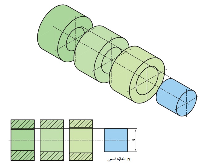
تلرانس و انطباقات محتویات محصول : پاورپوینت، pdf و تلرانس و انطباقات تعداد اسلاید های پاورپوینت : 21 اسلاید مفهوم تلرانس: طراح در طراحی و ساخت یک ماشین چند قطعه را در کنار هم قرار می دهد. ماشین مونتاژ شده باید بتواند انتظارطراح را برای برآورده کردن هدف خاصی دنبال ... ...
ایندکس نقشههای 1:250.000 و 1:50.000 و 1:25.000 توپوگرافی به فرمت شیپ فایل برای کل کشور به همراه فایل KMZ ایندکس 1:250.000 برای استفاده در GOOGLE EARTH ... ...
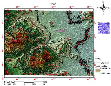
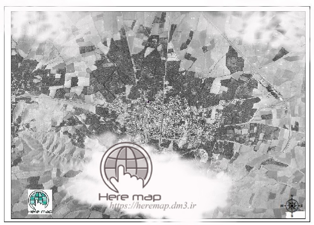
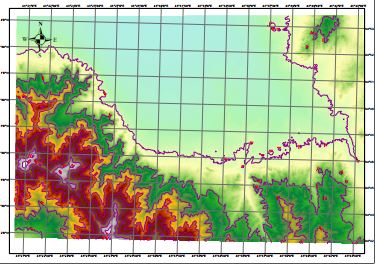
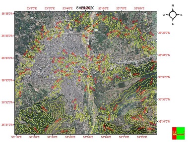
نقشه توپوگرافی شهر ارومیه و کوهستان های اطراف شهر ارومیه یکی از شهر های زیبای ایران به حساب می آید نام سابق این شهر رضایه بوده است. فرمت: PDF، شیپ فایل با لایه بندی قابل تفکیک ... ...
آشنایی با جی پی اس و نحوه کار با آن بصورت مرحله به مرحله ...

از سری جزوات مورد نیاز برای آمادگی آزمون امتحانی کارشناسی ارشد و دکتریفایل به صورت اسکن شده در قالبpdfو با خط بسیار خوانا آماده شده استدکتر نیکخواه طراح اصلی درس قارچ شناسی هستند وهرساله مخصوصا در مقطع دکتری چندین سوال از جزوه ایشون میادتوصیه میکنم حتما این جزوه رو تهیه ... ...
نقشه کاداستر شهرستان کاشان فایل اتوکد و با تمام جزییات نقشه های هوایی مناسب برای امور نقشه برداری ومساحی وطرح های تفصیلی شهرسازی ... ...
نقشه کاداستر شهرستان کاشان-قسمت دوم فایل اتوکد و با تمام جزییات نقشه های هوایی مناسب برای امور نقشه برداری ومساحی وطرح های تفصیلی شهرسازی(قبل از استفاده روی زمین توجیه شود) ... ...
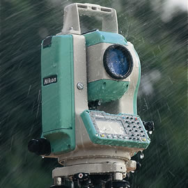
آموزش صفر تا صد کار با دوربین نقشه برداری نیکون تراز کردن نحوه یجاب باز کردن توجیه کردن دوربین روی ایستگاه های اصلی طریقه ی برداشت نقاط و ارتفاع دهی تخلیه کردن اطلاعات دوربین ... ...
دانلود نقشه توپوگرافی شهر همدان محتویات نقشه توپوگرافی همدان (PDF) مدل رقومی ارتفاع DEM (DEM File) مدل سه بعدی ارتفاع (JPG) فایل اتوکد خطوط میزان (CAD) فایل شیپ فایل خطوط میزان (Shp) ... ...
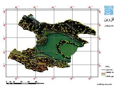
نقشه توپوگرافی استان قزوین فرمت PDF پی دی اف DWG اتوکد SHP شیپ فایل ... ...
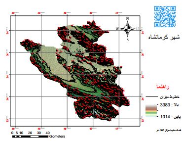
دانلود نقشه توپوگرافی شهرستان کرمانشاه ... ...
نقشه کاربردی مشهداتوکد2007 با نامگذاری خیابانها مناسب جهت امور شهرسازی وثبتی ... ...
در این فایل دو پاورپوینت در خصوص جی پی اس ارائه شده است که در یکی مقدماتی از جی پی اس، شناخت کلی، انواع ماهواره ها و سیستم زمینی و گیرنده ها و آنچه در ابتدا نیاز است از جی پی اس بدانیم آمده است. در پاورپوینت دوم نیز، مشاهدات، دقت و خطاهای اندازه گیری کار با این سیستم آمده است و ...
دانلود DEM استان کردستان فرمت: DEM حجم فایل زیپ: 41 مگابایت حجم: 120 مگابایت ... ...
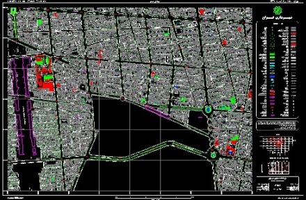
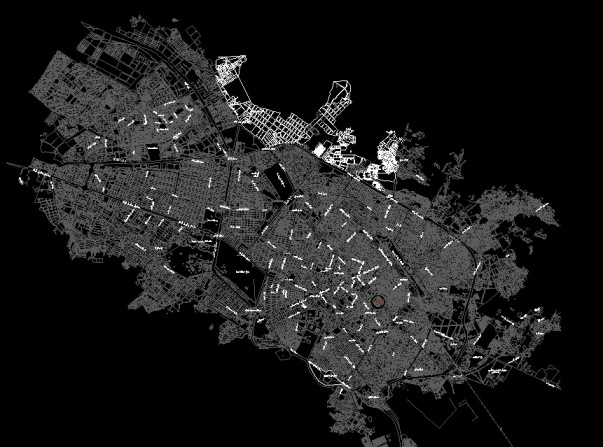
نقشه های اتوکدی مناطق 18گانه تهراننقشه هوایی شهر تهران 24 فایل اتوکد تهران ... ...
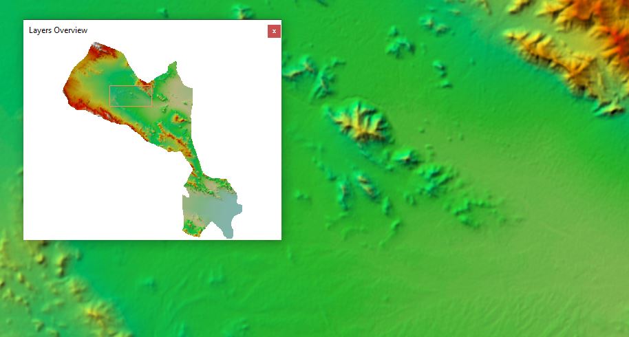
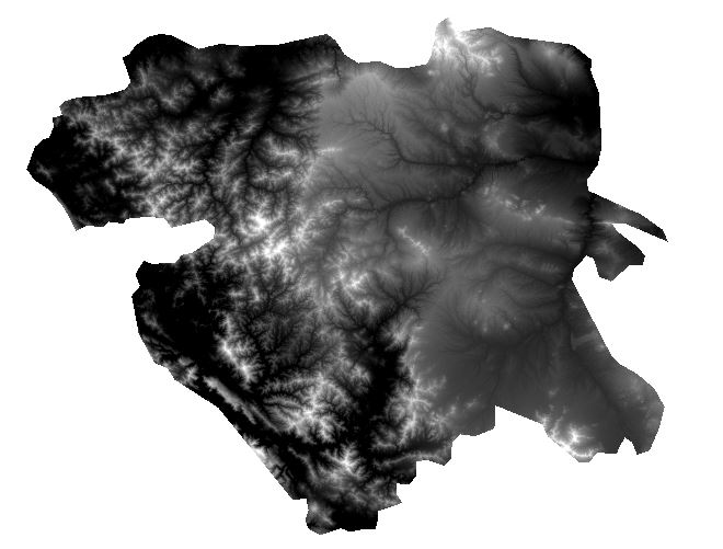
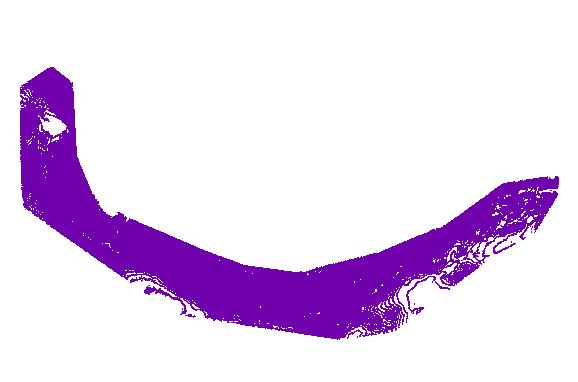
دانلود فایل وکتور کوه سبلان این مجموعه شامل 1) فایل وکتور (شیپ فایل) خطوط میزان کوهستان های سبلان 2) پی دی اف سه بعدی نقشه توپوگرافی کوهستان های سبلان 3) فایل توپوگرافی با فرمت sketch up به صورت سه بعدی از این کوهستان با سیستم تصویری UTM توجه: اگر به نقشه تپوگرافی با ... ...
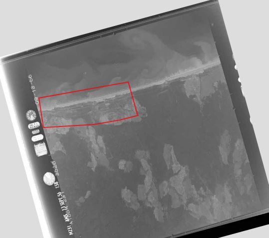
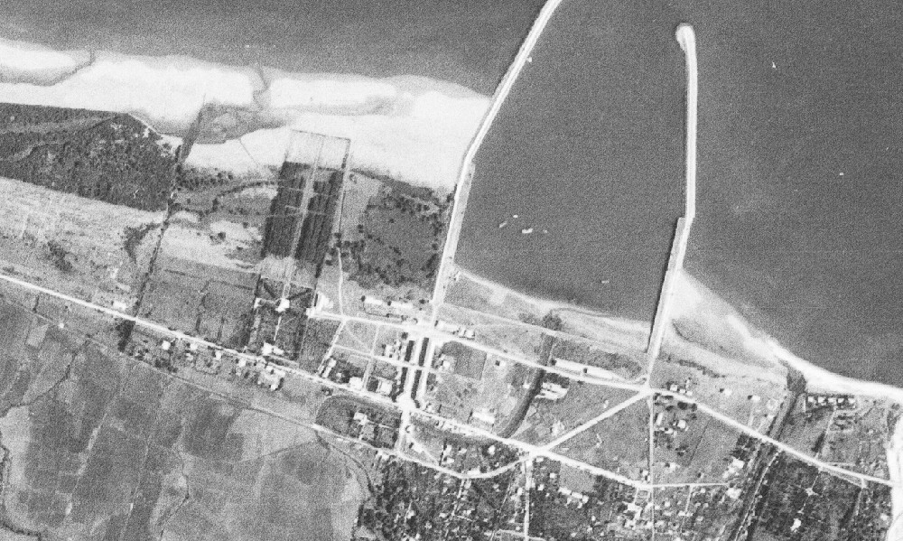
دانلود عکس هوایی قدیمی شهر نور مازندران عکس هوایی مربوط به سال 1956 فرمت TIFF تعداد فریم: 2 حجم: 120 مگابایت ... ...
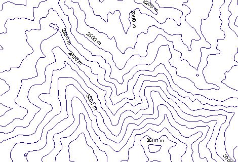
دانلود نقشه توپوگرافی رشته کوه البرز مشخصات نقشه نوع شیپ فایل : لاین، سیستم تصویری UTM مختصات فاصله بین خطوط میزان 100 متر ... ...
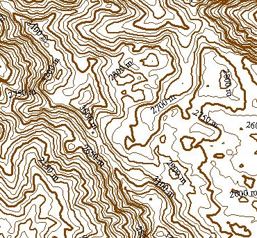
دانلود نقشه توپوگرافی کوهستان های شاهو به صورت سه بعدی در فرمت های PDF (آپدیت شده) kML گوگل ارث WDG اتوکد ... ...
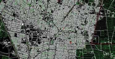
نقشه کاداستر و UTMشهرستان کویری آران و بیدگل اتوکد2007 ... ...
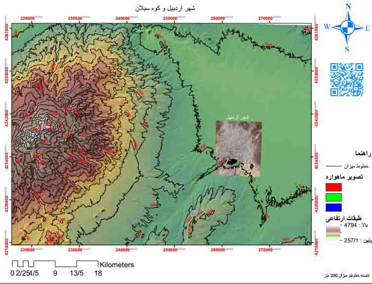
نقشه توپوگرافی شهر اردبیل و کوهستان های اطراف نقشه توپوگرافی شهر اردبیل و کوه سبلان در قالب PDF و شیپ فایل مشاهده نقشه ... ...
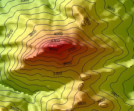
نقشه کوه آزاد کوه آزاد کوه یکی از کوه های مرتغع البرز مرکزی است که در استان مازندران قرار دارد. صعود به این کوه نیاز به تجهیزات و فنون کوهنوردی ندارد. ارتفاع آن 4355 متر است. فرمت: PDF و Shp با قابلیت فیلتر لایه ها ... ...

فرمت:pdf تعداد صفحات:42با قابلیت پرینت *لینک پشتیبانی کلیک کنید* تلفن پشتیبانی در تلگرام و واتساپ:09333076014 pinfile4kia@gmail.com ... ...
دانلود نقشه توپوگرافی شهر ساری ترکیب دو نقشه توپوگرافی و ماهواره ای کیفیت: 2000 Dbi عالی. حجم: 76 مگابایت ... ...
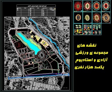
نقشه های مجموعه ی ورزشی آزادی و استادیوم یکصد هزار نفری نقشه های ارائه شده در این فایل عبارتند از: - طرح چامع (سایت پلان) مجموعه ی ورزشی آزادی با جایگذاری استادیوم، دریاچه و ورزشگاه های مختلف و بافت اطراف - پلان طبقات زیرین، همکف، اول و دوم استادیوم یکصدهزار نفری. - ... ...
دانلود نقشه توپوگرافی استان هرمزگان در فرمت: PDF Shp JPEG ... ...
اگر به یک وب سایت یا فروشگاه رایگان با فضای نامحدود و امکانات فراوان نیاز دارید بی درنگ دکمه زیر را کلیک نمایید.
ایجاد وب سایت یامحبوب ترین ها
پرفروش ترین ها
پر فروش ترین های فورکیا
دانلودنسخه PDF جزوه کامل چیلر و برج خنک کن همراه با نمودار نصب و تعمیر(دانش یاران) برنامه های نقشه برداری برای ماشین حساب CASIO 4500 جزوه پیمایش به همراه فایل اکسل محاسبه پیمایش پاور پوینت به همراه توضیحات مبحث تلرانس ها و انطباقات برای کنفرانس شیپ فایل ایندکس نقشههای توپوگرافی ایران دانلود نقشه توپوگرافی شهر ارومیه و کوهستان های اطراف جزوه قارچ شناسی تکمیلی دکتر جوان نیکخواه97 نقشه اتوکد کاداستر کاشان-قسمت اول نقشه کاداستر کاشان-قسمت دوم نحوه یکار کردن صفر تا صد با دوربین نقشه برداری نیکون دانلود نقشه توپوگرافی شهر همدان دانلود نقشه توپوگرافی استان قزوین دانلود نقشه توپوگرافی شهرستان کرمانشاه نقشه هوایی شهر مشهد دانلود DEM استان کردستان نقشه های هوایی تهران دانلود فایل وکتور نقشه توپوگرافی کوه سبلان دانلود عکس هوایی قدیمی شهر نور مازندران دانلود نقشه توپوگرافی رشته کوه البرز دانلود نقشه توپوگرافی کوهستان های شاهو نقشه هوایی وکاداستر شهر آران و بیدگل دانلود نقشه توپوگرافی شهر اردبیل و کوهستان های اطراف دانلود نقشه کوه آزاد کوه جزوه الکترونیک 3 یا همان الکترونیک آنالوگ دکتر مروی1399 دانلود نقشه توپوگرافی شهر ساری نقشه های اتوکدی مجموعه ی ورزشی آزادی و استادیوم یکصد هزار نفری دانلود نقشه توپوگرافی استان هرمزگانمطالب تصادفی