امروز شنبه ۲۲ اردیبهشت ۱۴۰۳
دسته بندی سایت
برچسب های مهم
پیوند ها

Glossary of Remote Sensing
ABSORPTION
The process by which radiant energy is absorbed and converted into other forms of energy.
ACTIVE SYSTEM
A remote sensing system that provides its own source of energy and records the energy reflected or refracted back to the sensor.
ADVANCED VERY HIGH RESOLUTION RADIOMETER (AVHRR)
Crosstrack multispectral scanner on a NOAA polar-orbiting satellite that acquires five spectral bands of data (0.55 to 12.50m) with a ground resolution cell of 1.1 by 1.1 km.
ALBEDO
Ratio of the amount of electromagnetic energy reflected by a surface to the amount of energy incident upon it.
ALTIMETER
Instrument for measuring platform altitude.
ANALOG DISPLAY
A form of data display in which values are shown in graphic form, such as curves. Differs from digital displays in which values are shown as arrays of numbers.
ATMOSPHERIC-ABSORPTION
The process whereby some or all of the energy of sound waves or electromagnetic waves is transferred to the constituents of the atmosphere.
ATMOSPHERIC CORRECTION
Image-processing procedure that compensates for effects of selectivity scattered light in multispectral images.
AUTOMATIC CLASSIFICATION
Process whereby data (usually image data) are analysed and classified according to automatic or semi-automatic classification algorithms as opposed to purely manual methods.
AZIMUTH
Geographic orientation of a line given as an angle measured in degrees clockwise from North.
BACKSCATTER
In radar, the portion of the microwave energy scattered by the terrain surface directly back toward the antenna to be received and recorded by the sensor.
BAND
A wavelength interval in the electromagnetic spectrum. For example, in Landsat images the bands designate specific wavelength intervals at which images are acquired. The term channel is also in common use with the same meaning as band.
BANDWIDTH
A certain range of frequencies within a band. Fundamental parameter of any imaging system. It determines the ultimate resolution available.
BINARY
Based upon the integer two. Binary Code is composed of a combination of entities that can assume one of two possible conditions (0 or 1).
BRIGHTNESS
The attribute of visual perception in accordance with which an area appears to emit more or less light.
CALIBRATION
Process of comparing an instruments measurements with a standard.
CHANNEL
A range of wavelength intervals selected from the electromagnetic spectrum.
CLASSIFICATION
Process of assigning individual pixels of an image to categories, generally on the basis of spectral reflectance characteristics.
CLUSTERING
Multivariate statistical technique which separates image data into groups such that the between-group variance of the specified number of groups is maximized. A mathematical procedure for organizing multispectral data into spectrally homogeneous groups.
COLOUR COMPOSITE
A colour image produced by assigning a colour to a particular spectral band.
COLOUR INFRARED
A false colour film different from ordinary colour film in that the three sensitized layers are sensitive to green, red and infrared radiation instead of blue, green and red.
CONTRAST-STRETCHING
Improving the contrast of images by digital processing. The original range of digital values is expanded to utilize the full contrast range of the recording film or display device.
DETECTOR
Detectors serve to transform incident radiation levels into electrical signals that can be recorded.
DIGITAL ELEVATION MODEL (DEM)
A quantitative model of a landform in digital form.
DIGITAL IMAGE
Image data represented as a series of binary digits.
DIGITAL NUMBER (DN)
Value assigned to a pixel in a digital image.
DIGITIZATION
Digitization of graphics typically involves recording the location of each point, line, and polygon on a map, along with their associated labels and attributes.
EDGE-DETECTION
Computer process to define boundaries on remote sensing imagery.
ELECTROMAGNETIC SPECTRUM
The ordered array of known electromagnetic energy extending from cosmic rays, through gamma rays, X-rays to ultraviolet, visible and infrared radiation including microwave energy.
ENHANCEMENT
Process of altering the appearance of an image so that the interpreter can extract more information.
FALSE COLOUR
A colour imaging process which produces an image of a colour that does not correspond to the true colour of the scene (as seen by our eyes).
FREQUENCY
The number of wave oscillations per unit time or the number of wavelengths that pass a point per unit time.
GEOCODING
Process by which imagery is corrected for all source-dependent errors and geometrically transformed to the desired map projection, being resampled to a standard square pixel size.
GEOGRAPHIC INFORMATION SYSTEM(GIS)
An organized collection of computer hardware and software designed to efficiently create, manipulate, analyze and display all types of geographically or spatially referenced data. A GIS allows complex spatial operations.
GEOMETRIC CORRECTION
Image-processing procedure that corrects spatial distortions in an image.
GEOSTATIONARY
Refers to satellites travelling at the angular velocity at which the earth rotates; as a result, they remain above the same point on earth at all times.
GREY SCALE
A calibrated sequence of grey tones ranging from black to white.
GROUND-CONTROL POINTS (GCP)
A system of points with known location that is recognizable on images and can be used to determine geometrical correction.
GROUND-STATION
Data collection, receiving or processing facilities located on the ground.
IHS
Intensity, hue, and saturation system of colours.
IMAGE CONTRAST
The difference in tone between light and dark areas of the image.
IMAGE PROCESSING
Encompasses all the various operations which can be applied to photographic or image data. These include, but are not limited to image compression, image restoration, image enhancement, preprocessing, quantization, spatial filtering and other image pattern recognition techniques.
INCIDENCE ANGLE
In radar, the angle formed between an imaginary line normal to the surface and another connecting the antenna and the target.
INFRARED-BAND (IR)
The band of electromagnetic wavelengths lying between the extreme of the visible (approximately 0.70 micrometer) and the shortest microwaves (approximately 100 micrometers).
LOOK ANGLE
Direction in which pulses of microwave energy are transmitted by a radar system.
METRIC CAMERA
Photogrammetric camera that enables geometrically accurate reconstruction of the optical model of the object scene from its stereo photographs.
MICROWAVE
Electromagnetic radiation having wavelengths between 1 m and 1 mm. The most common imaging radars operate at frequencies between 24cm and 0.85 cm.
MID-INFRARED (MIR)
The range of wavelengths from 8 to 14 micrometres dominated by emission of thermally generated radiation from materials; also known as thermal infrared.
MIXED PIXEL
Those pixels having a signature representative of more than one class (as with boundary pixels) or pixels saturated by strong reflectance or emittance of a sub-pixel size feature.
MOMS
Modular optoelectric multispectral scanner.
MOSAIC
A technique whereby multiple satellite images are digitally joined, while correcting for systematic changes in radiometry and geometry thus creating a seamless image product.
MSS
Multispectral scanner system of Landsat that acquires images of four wavelength bands in the visible and reflected IR regions.
MULTISPECTRAL
Generally used for remote sensing in two or more spectral bands, such as visible and infrared.
NASA
National Aeronautics and Space Administration, headquarters in Washington, DC, USA.
NEAR-INFRARED
Infrared radiation extending approximately from 0.7 to 1.3 micrometers and being part of the radiative infrared.
NOISE
Random or repetitive effects which degrade the information-bearing quality of signals.
NONPARAMETRIC-CLASSIFICATION
A nonparametric classification rule is one which makes no assumptions about the functional form of the conditional probability distributions of the patterns given the categories.
NOAA
National Oceanic and Atmospheric Administration.
ORBIT
Path of a satellite around a body such as the earth, under the influence of gravity.
ORTHOIMAGE
An image derived from a conventional perspective image by simple or differential rectification so that image displacements caused by sensor tilt and relief of terrain are removed.
PANCHROMATIC CHANNEL
A channel of a sensor detector system covering the entire visible part of the electromagnetic spectrum.
PASSIVE SYSTEM
A sensing system that detects or measures radiation emitted by the target.
PATH AND ROW
World wide index system for locating Landsat satellite images.
PAYLOAD
Sensing equipment carried on a platform.
PHOTOGRAMMETRY
Science and technology of obtaining reliable measurements and maps from photographs.
PICTURE ELEMENT (PIXEL)
In a digitized image, the area on the ground represented by each digital number. The spatial variable defines the size of the resolution cell, the spectral variable defines the intensity of the spectral response. Commonly contracted to pixel.
PLATFORM
The vehicle which carries a sensor. i.e. satellite, aircraft, balloon, etc...
POLAR ORBIT
An orbit that passes close to the poles, thereby enabling a satellite to pass over most of the surface of the earth, except the immediate vicinity of the poles themselves.
PREPROCESSING
Initial stages of data processing.
PROJECTION
A systematic drawing of lines on a plane surface (i.e. a map) to represent the parallels of latitude and the meridians of longitude of the earth or a section of it.
QUICK LOOK
Imagery produced either on line with data transmission or immediately after data reception. The imagery lack the various computer corrections but has sufficient resolution and clarity to provide visual information about the general data quality and cloud cover.
RADAR
Acronym for Radio Detection and Ranging. A method, a system, or a technique for using beam, reflected, and timed electromagnetic radiation to detect, locate, and track objects, to measure distance (altitude), and to acquire terrain imagery. The term radar in remote sensing terminology refers to active microwave systems (from about 1 GHz - 100 GHz; the majority of current instruments operate below 10 GHz).
RADIATION
The emission and propagation of waves transmitting energy through space or through some medium.
RASTER-DATA
A data set built up from a matrix of columns and rows each cell in the matrix being addressable by its coordinates and linkable to one or more attribute values.
REFLECTANCE
Ratio of the radiant energy reflected by a body to the energy incident on it. Spectral reflectance is the reflectance measured within a specific wavelength interval.
REFLECTIVITY
Ability of a surface to reflect incident energy.
REMOTE SENSING
Technique of acquiring information about an area or an object from a distance without being in physical contact with the object.
RESAMPLING
A technique in digital image processing by which the geometric transformations are applied to the original data. Through a process of interpolation, the output pixel values are derived as functions of the input pixel values combined with the computed distortion. Nearest neighbour, bilinear interpolation and cubic convolution are commonly used resampling techniques.
RESOLUTION
In satellite imagery it refers to the smallest object that can be discerned. Also referred to as spatial resolution. Resolution may also be expressed in terms of spectral resolution.
SATELLITE IMAGE
A remotely sensed image (by CCD camera or radar) is a two-dimensional grid of data; each of its elements is a pixel (picture element) whose coordinates are known and whose light intensity has a DN (Digital Number) value. The coordinates of the pixels and their DN values describe the image as rows, called lines, and columns, called samples. An 8-bit pixel provides up to 256 brightness levels (level 0 is set to black, while level 255 is set to white), the brightness levels are also referred to as grey levels. In false colour image processing, those pixels which have the same DN value are given an arbitrary colour. This technique is used, for example, to differentiate between various types of terrain or species of vegetation - to show changes, which are otherwise not perceptible to the human eye.
SATELLITE ORBIT
The curved path, usually elliptical, described by a satellite about the Earth.
SCATTERING
Multiple reflections of electromagnetic waves by particles or surfaces.
SCENE
Area on the ground that is covered by a satellite image or photograph.
SENSOR
An instrument, usually consisting of optics, detectors, and electronics, that collects radiation and converts it into some other form suitable for obtaining information. This may be a certain pattern (an image, a profile, etc.), a warning, a control signal, or some other signal.
SENSOR SWATH
The width of the track covered by a sensing system on the surface of the Earth.
SPECTRAL ANALYSIS
Study of data with respect to different spectral responses.
SPECTRAL BAND
An interval in the electromagnetic spectrum defined by two wavelengths, two frequencies, or two wave numbers.
SPECTRAL SIGNATURE
Quantitative measurement of the properties of an object at one or several wavelength intervals.
STEREOSCOPIC IMAGE
That mental impression of a three-dimensional object which results from stereoscopic vision (stereo viewing).
SUBSCENE
A portion of an image that may be used for detailed analysis.
SUN SYNCHRONOUS ORBIT
An Earth satellite orbit in which the orbital plane is near polar and the altitude is such that a satellite will always pass over a specific place on earth at the same local sun time and at fixed time intervals (e.g. once every 18 days).
TEXTURE
In a photographic image the frequency of change and arrangement of tones.
THEMATIC MAPPER
A high-resolution scanner system on board the LANDSAT-4 and LANDSAT-5 satellites.
THERMAL BAND
A general term for middle-infrared wavelengths which are transmitted through the atmospheric window at 8-13 micrometers. Occasionally also used for the windows around 3-6 micrometers.
TRAINING AREA
A sample of the Earths surface with known properties; the statistics of the imaged data within the area are used to determine decision boundaries in classification.
TRUE-COLOUR
A colour imaging process whereby the colour of the image is the same as the colour of the object imaged (natural colour images).
VECTOR DATA
A coordinate-based data structure commonly used to represent map features using points, lines, and polygons, digitally encoded according to theirorigins, breakpoints and terminators.
VEGETATION INDEX
The reduction of multispectral scanning measurements to a single value for predicting and assessing vegetative characteristics such as plant leaf area, total biomass and general plant stress and vigor.
VIEWING ANGLE
The acute angle between the looking axis of the sensor and the horizontal or ground elevation surface.
VISIBLE-BAND
The band of the electromagnetic spectrum in which the human eye is sensitive. This band ranges from 0.4 - 0.7 micrometres.
VISUAL INTERPRETATION
The interpretation of imagery by non-computerized methods.
Sources:
Glossary of the Manual of Remote Sensing.
Glossary of the Canada Centre for Remote Sensing
برنامه ها بصورت زیر هستند: نقشه برداری 1-تبدیل زاویه دسیمال به درجه دقیقه و ثانیه و برعکس 2-محاسبه آزیموت 3-مسئله تقاطع 4-ترازیابی تدریجی 5-پیمایش بسته فتوگرامتری 1-تصحیح شکست اتمسفر 2-تغییربعدفیلم 3-اعوجاج عدسی 4-توجیه داخلی 5-توجیه خارجی ژئودزی 1-تبدیل سیستم مختصات لحظه ...

دانلودنسخه PDF جزوه کامل چیلر و برج خنک کن همراه با نمودار نصب و تعمیر(دانش یاران) لطفا جهت دانلود فایل اصلی و PDF جزوه عملیات خرید را انجام دهید توجه داشته باشید بعد از اتمام خرید فایل در دو نسخه قابل دانلود می باشد 1- دانلود فایل از لینک 2 - دانلود فایل ... ...

این فایل را از سایت جدید ما با تخفیف دریافت کنید (کلیک کنید) این جزوه شامل تعدادی از برنامههای ماشین حساب ، مورد استفاده در کارهای نقشهبرداری بخصوص راه سازی بوده و نحوه استفاده آنها همراه با مثال توضیح داده شده است. برنامه ژیزمان: تعیین ژیزمان یک امتداد ... ...

این فایل را از سایت جدید ما با تخفیف دریافت کنید(کلیک کنید) جهت تهیه نقشه از یک منطقه نیاز به ایجاد اسکلتی بر روی زمین است که این اسکلت از یک سری نقاط ( کانواهای نقشه برداری ) تشکیل می گردد . مختصات مسطحاتی و ارتفاعی نقاط این اسکلت معلوم می باشد و بر پایه نقاط این اسکلت ... ...
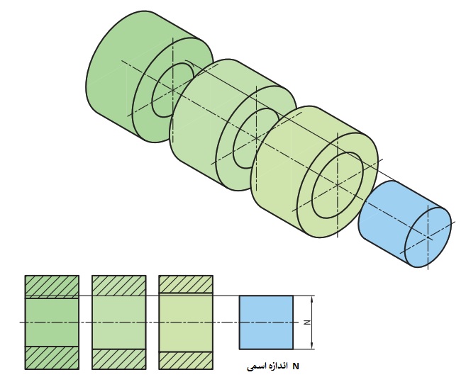
تلرانس و انطباقات محتویات محصول : پاورپوینت، pdf و تلرانس و انطباقات تعداد اسلاید های پاورپوینت : 21 اسلاید مفهوم تلرانس: طراح در طراحی و ساخت یک ماشین چند قطعه را در کنار هم قرار می دهد. ماشین مونتاژ شده باید بتواند انتظارطراح را برای برآورده کردن هدف خاصی دنبال ... ...
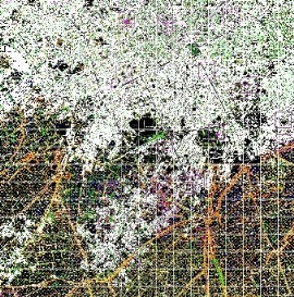
ایندکس نقشههای 1:250.000 و 1:50.000 و 1:25.000 توپوگرافی به فرمت شیپ فایل برای کل کشور به همراه فایل KMZ ایندکس 1:250.000 برای استفاده در GOOGLE EARTH ... ...
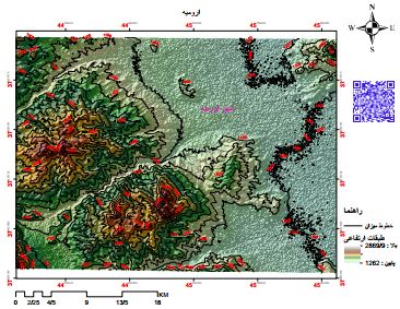
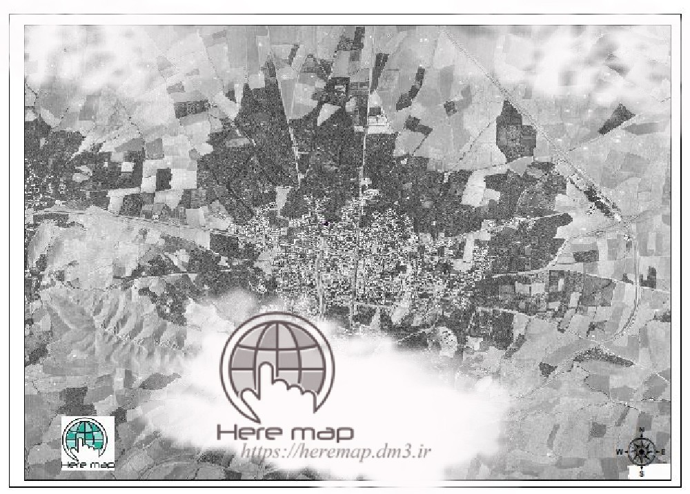
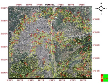
نقشه توپوگرافی شهر ارومیه و کوهستان های اطراف شهر ارومیه یکی از شهر های زیبای ایران به حساب می آید نام سابق این شهر رضایه بوده است. فرمت: PDF، شیپ فایل با لایه بندی قابل تفکیک ... ...
دانلود نقشه توپوگرافی شهر همدان محتویات نقشه توپوگرافی همدان (PDF) مدل رقومی ارتفاع DEM (DEM File) مدل سه بعدی ارتفاع (JPG) فایل اتوکد خطوط میزان (CAD) فایل شیپ فایل خطوط میزان (Shp) ... ...
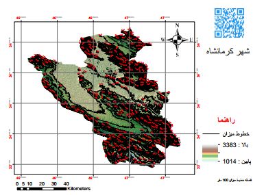
دانلود نقشه توپوگرافی شهرستان کرمانشاه ... ...
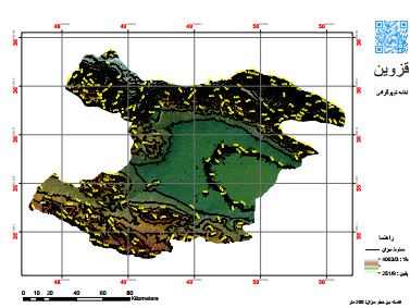
نقشه توپوگرافی استان قزوین فرمت PDF پی دی اف DWG اتوکد SHP شیپ فایل ... ...
آشنایی با جی پی اس و نحوه کار با آن بصورت مرحله به مرحله ...

از سری جزوات مورد نیاز برای آمادگی آزمون امتحانی کارشناسی ارشد و دکتریفایل به صورت اسکن شده در قالبpdfو با خط بسیار خوانا آماده شده استدکتر نیکخواه طراح اصلی درس قارچ شناسی هستند وهرساله مخصوصا در مقطع دکتری چندین سوال از جزوه ایشون میادتوصیه میکنم حتما این جزوه رو تهیه ... ...
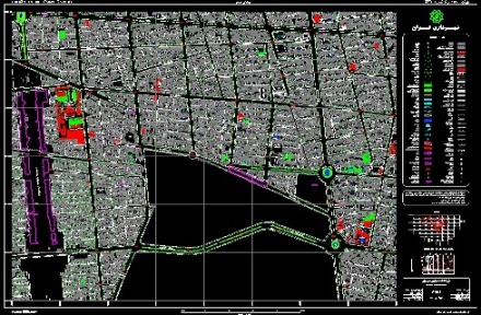
نقشه کاداستر شهرستان کاشان فایل اتوکد و با تمام جزییات نقشه های هوایی مناسب برای امور نقشه برداری ومساحی وطرح های تفصیلی شهرسازی ... ...
نقشه کاداستر شهرستان کاشان-قسمت دوم فایل اتوکد و با تمام جزییات نقشه های هوایی مناسب برای امور نقشه برداری ومساحی وطرح های تفصیلی شهرسازی(قبل از استفاده روی زمین توجیه شود) ... ...
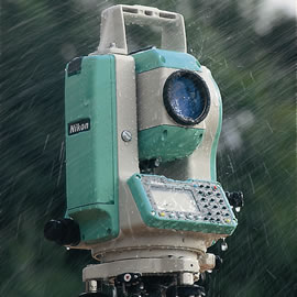
آموزش صفر تا صد کار با دوربین نقشه برداری نیکون تراز کردن نحوه یجاب باز کردن توجیه کردن دوربین روی ایستگاه های اصلی طریقه ی برداشت نقاط و ارتفاع دهی تخلیه کردن اطلاعات دوربین ... ...
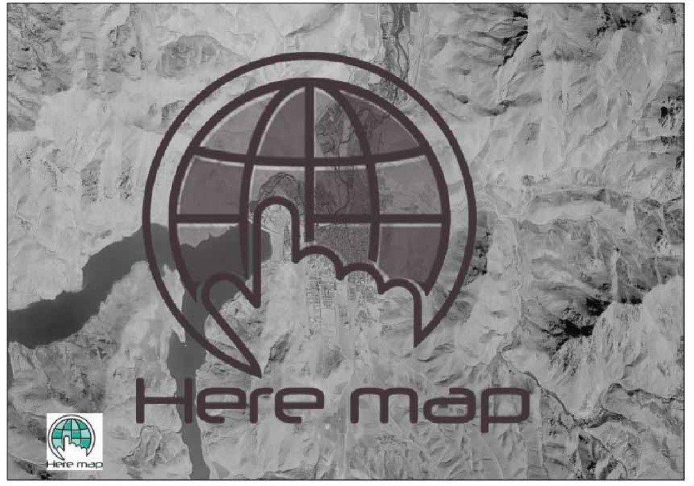
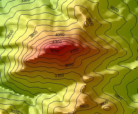
دانلود فایل وکتور کوه سبلان این مجموعه شامل 1) فایل وکتور (شیپ فایل) خطوط میزان کوهستان های سبلان 2) پی دی اف سه بعدی نقشه توپوگرافی کوهستان های سبلان 3) فایل توپوگرافی با فرمت sketch up به صورت سه بعدی از این کوهستان با سیستم تصویری UTM توجه: اگر به نقشه تپوگرافی با ... ...
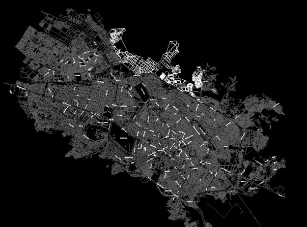
نقشه کاربردی مشهداتوکد2007 با نامگذاری خیابانها مناسب جهت امور شهرسازی وثبتی ... ...
در این فایل دو پاورپوینت در خصوص جی پی اس ارائه شده است که در یکی مقدماتی از جی پی اس، شناخت کلی، انواع ماهواره ها و سیستم زمینی و گیرنده ها و آنچه در ابتدا نیاز است از جی پی اس بدانیم آمده است. در پاورپوینت دوم نیز، مشاهدات، دقت و خطاهای اندازه گیری کار با این سیستم آمده است و ...
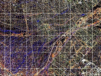
دانلود نقشه توپوگرافی شهر ساری ترکیب دو نقشه توپوگرافی و ماهواره ای کیفیت: 2000 Dbi عالی. حجم: 76 مگابایت ... ...
دانلود DEM استان کردستان فرمت: DEM حجم فایل زیپ: 41 مگابایت حجم: 120 مگابایت ... ...
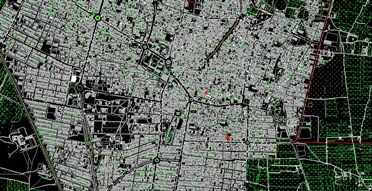
نقشه های اتوکدی مناطق 18گانه تهراننقشه هوایی شهر تهران 24 فایل اتوکد تهران ... ...
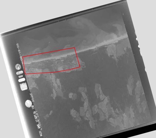
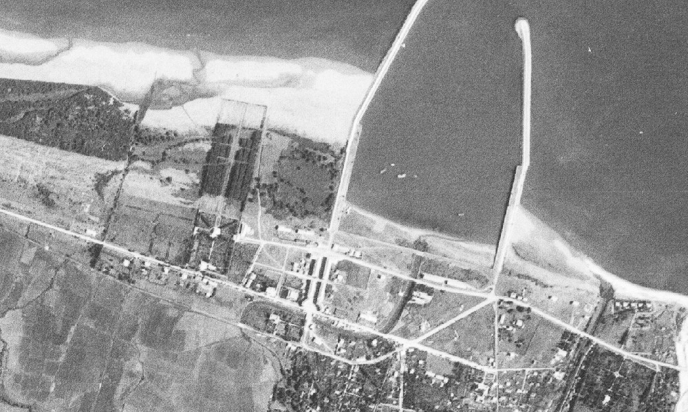
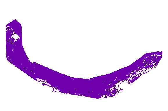
دانلود عکس هوایی قدیمی شهر نور مازندران عکس هوایی مربوط به سال 1956 فرمت TIFF تعداد فریم: 2 حجم: 120 مگابایت ... ...
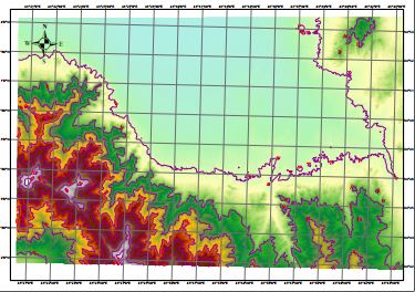
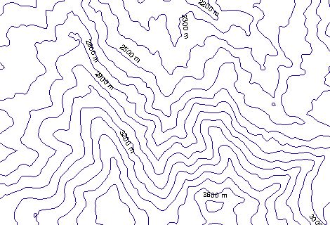
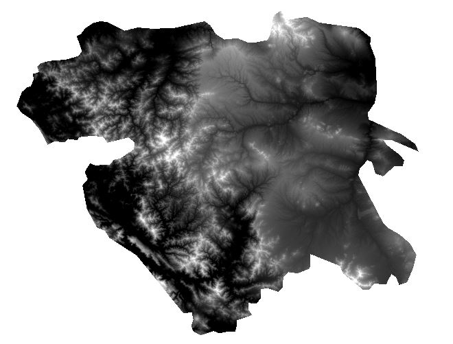
دانلود نقشه توپوگرافی رشته کوه البرز مشخصات نقشه نوع شیپ فایل : لاین، سیستم تصویری UTM مختصات فاصله بین خطوط میزان 100 متر ... ...
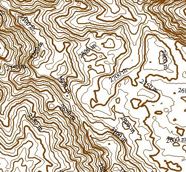
دانلود نقشه توپوگرافی کوهستان های شاهو به صورت سه بعدی در فرمت های PDF (آپدیت شده) kML گوگل ارث WDG اتوکد ... ...
نقشه کاداستر و UTMشهرستان کویری آران و بیدگل اتوکد2007 ... ...
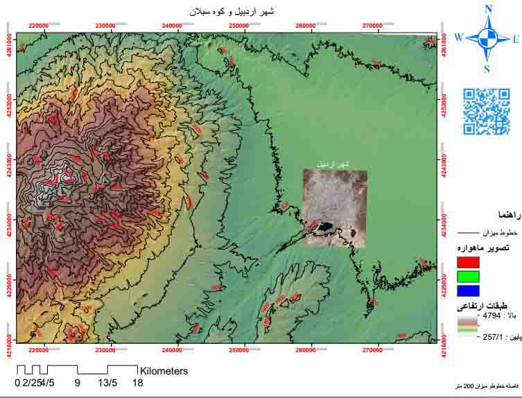
نقشه توپوگرافی شهر اردبیل و کوهستان های اطراف نقشه توپوگرافی شهر اردبیل و کوه سبلان در قالب PDF و شیپ فایل مشاهده نقشه ... ...
نقشه کوه آزاد کوه آزاد کوه یکی از کوه های مرتغع البرز مرکزی است که در استان مازندران قرار دارد. صعود به این کوه نیاز به تجهیزات و فنون کوهنوردی ندارد. ارتفاع آن 4355 متر است. فرمت: PDF و Shp با قابلیت فیلتر لایه ها ... ...

فرمت:pdf تعداد صفحات:42با قابلیت پرینت *لینک پشتیبانی کلیک کنید* تلفن پشتیبانی در تلگرام و واتساپ:09333076014 pinfile4kia@gmail.com ... ...
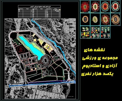
نقشه های مجموعه ی ورزشی آزادی و استادیوم یکصد هزار نفری نقشه های ارائه شده در این فایل عبارتند از: - طرح چامع (سایت پلان) مجموعه ی ورزشی آزادی با جایگذاری استادیوم، دریاچه و ورزشگاه های مختلف و بافت اطراف - پلان طبقات زیرین، همکف، اول و دوم استادیوم یکصدهزار نفری. - ... ...
دانلود نقشه توپوگرافی استان هرمزگان در فرمت: PDF Shp JPEG ... ...
اگر به یک وب سایت یا فروشگاه رایگان با فضای نامحدود و امکانات فراوان نیاز دارید بی درنگ دکمه زیر را کلیک نمایید.
ایجاد وب سایت یامحبوب ترین ها
پرفروش ترین ها
پر فروش ترین های فورکیا
دانلودنسخه PDF جزوه کامل چیلر و برج خنک کن همراه با نمودار نصب و تعمیر(دانش یاران) برنامه های نقشه برداری برای ماشین حساب CASIO 4500 جزوه پیمایش به همراه فایل اکسل محاسبه پیمایش پاور پوینت به همراه توضیحات مبحث تلرانس ها و انطباقات برای کنفرانس شیپ فایل ایندکس نقشههای توپوگرافی ایران دانلود نقشه توپوگرافی شهر ارومیه و کوهستان های اطراف دانلود نقشه توپوگرافی شهر همدان دانلود نقشه توپوگرافی شهرستان کرمانشاه دانلود نقشه توپوگرافی استان قزوین جزوه قارچ شناسی تکمیلی دکتر جوان نیکخواه97 نقشه اتوکد کاداستر کاشان-قسمت اول نقشه کاداستر کاشان-قسمت دوم نحوه یکار کردن صفر تا صد با دوربین نقشه برداری نیکون دانلود فایل وکتور نقشه توپوگرافی کوه سبلان نقشه هوایی شهر مشهد دانلود نقشه توپوگرافی شهر ساری دانلود DEM استان کردستان نقشه های هوایی تهران دانلود عکس هوایی قدیمی شهر نور مازندران دانلود نقشه توپوگرافی رشته کوه البرز دانلود نقشه توپوگرافی کوهستان های شاهو نقشه هوایی وکاداستر شهر آران و بیدگل دانلود نقشه توپوگرافی شهر اردبیل و کوهستان های اطراف دانلود نقشه کوه آزاد کوه جزوه الکترونیک 3 یا همان الکترونیک آنالوگ دکتر مروی1399 نقشه های اتوکدی مجموعه ی ورزشی آزادی و استادیوم یکصد هزار نفری دانلود نقشه توپوگرافی استان هرمزگانمطالب تصادفی